Saturday, September 25, 2010

Snakes, Rattle and Coil

You adventurous outdoor enthusiasts who refuse to let a little heat keep you from venturing in the wild need to be extra careful about where you step.
Experts say rattle snakes are especially active when the temperature outside starts to rise.
That make sense, considering I almost stepped on the fanged reptile to the left during a recent hike along Coldbrook Creek Canyon in the San Gabriel Mountains. This creek eventually dumps into the San Gabriel Reservoir.
There are a couple of good fishing spots along the North Fork, near the OHV Entrance Station in San Gabriel Canyon. However, the area is overrun with families and picnickers on the weekends. That's why I explored the river further upstream to look for a place to drop a line and accidentally met up with the snake in the grass that you see above.
So, stay safe! Stay on marked paths and trails. Wear hiking boots and thick pants if you are going to venture into the brush. And look before you step.
Happy hiking.

Monday, September 13, 2010

Look for Osprey in Upper Newport Bay

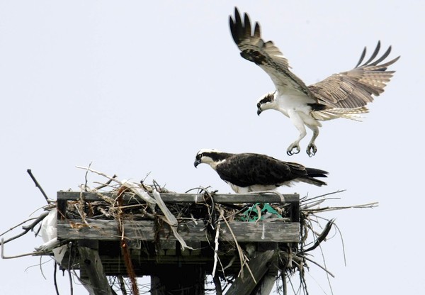
The Osprey, a majestic bird that makes its home near water, is making a comeback in Southern California.
It's great news because these are beautiful birds to watch in action. I just got back from my annual vacation in Huntington Lake where I joined the Osprey in a daily hunt for trout in the beautiful mountain lake. My efforts were an epic failure but I enjoyed watching the Osprey soar over the surface and dive to pluck the floundering fish from the lake.
If you have never seen an Osprey before, think of a cross between a seagull and an eagle, with a call that sounds like a crying baby.
To see the Osprey, check out the Upper Newport Bay Nature Preserve and Ecological Reserve. Follow the link for hours and directions. The preserve boasts one of the largest coastal wetland in southern California, and is renowned as one of the finest bird watching sites in North America.

(Photo: Osprey nest near the Upper Newport Bay. Credit: Los Angeles Times.)

Friday, August 6, 2010

It's not too late to see Bald Eagles


Our nation's iconic symbol, haliaeetus leucocephalus, spends most of the summer in cool places like Alaska and Canada. But with some luck you can spot a couple of Bald Eagles here in Southern California.
Big Bear Lake in the San Bernardino Mountains has been home to dozens of Bald Eagles, most visible in the winter but a few hang around in the summer.

The best way to see them is to check into the Big Bear Discovery Center on the northeast end of the lake. From the center you can join a canoe or kayaking tour of the lake. The eagles usually nest in the tallest trees closest to the water. The juveniles look like Golden Eagles, covered with brown feathers. But there is no confusing them with any other bird when you see an adult eagle, sailing on a wind current.

For more information, call 909-866-3437.

(Photo credit: bigbearblogs.com)


Sunday, August 1, 2010

Training to bag Mt. Whitney (Mt. Wilson)

It's been on my bucket list to hike to the peak of Mt. Whitney, the tallest summit in the lower 48 states. If you have the same wish, between now and early October is probably the best time to do it before the winter weather sets in. But before you attempt such a feat, you have to train a bit so you don't poop out half way up the mountain. To get in shape to tackle Mt. Whitney, many people choose Mt. San Gorgonio in the San Bernardino Mountains. It is the highest peak in Southern California at 11,503 feet in elevation.
I haven't hiked Mt. San Gorgonio but another good training site is Mt. Wilson, the 5,710 feet peak overlooking the San Gabriel Valley. If you begin at Eaton Canyon Nature Park in Altadena, you will hike about 12 miles each way with an elevation gain of 4,400 feet. I did this hike last summer in the midst of a stifling heat wave.
From Eaton Canyon park, go to the nature center where you can get a map that shows how to look up to the Mt. Wilson Toll Road. It probably won't be necessary. Just follow the main trail up the creek and when you get to the big concrete bridge, follow the wide dirt trail up the mountain. You won't find any water until you get to a small hike-in campsite halfway up the mountain. The terrain ranges from dry, dusty chaparral to shady pine and oak forests. Keep an eye out for bear, which have been spotted in the area. To read up on the toll road, check out this Wikipedia site.
Directions: From the 210 Freeway, take the Altadena exit east. After you past New York Ave. look for the Eaton Canyon Nature Park on your right. Park and follow the creek up river.
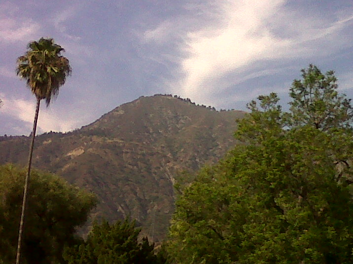
(Photo: Mt. Wilson from Altadena.)

Thursday, July 29, 2010

Hiking is for the dogs (Griffith Park)

The dog days of summer are here and you don't want to leave Fido at home while you're exploring the great outdoors. If you're looking for good hiking trails where your pooch is welcome, you will find no shortage of suggestions from a stack of books on the subject. You energetic and athletic types can try hiking up Solstice Canyon from Malibu into the Santa Monica Mountains. You'll get a good workout and see some gorgeous views. But be warned that the park rangers have been cracking down on dog owners who ignore the leash law.
But for those who are looking just to have a short adventure with man's best friend, try meeting up with the Angeles Chapter of the Sierra Club. These friendly tree huggers meet Tuesday, Wednesday and Thursday nights around 7 p.m. at the upper Merry-Go-Round parking lot at Griffith Park. The hike along dirt trails is not strenuous but it stretches out into the night so bring a flashlight and water for you and your dog. The highlight of the hike comes when you reach Bee Rock, a summit that offers a view of exotic, glimmering Glendale after dark. For details, call the chapter headquarters at (213) 387-4287.
(Photo: An unleashed dog hikes toward Bee Rock in Griffith Park. Credit: Los Angeles Times.)

Saturday, August 1, 2009

Hiking with the rug rats (Millard Canyon Falls)


What's so great about it? The hike up to Millard Canyon Falls is less than a mile long, alongside a trickling creek, under the shade of oaks, eucalyptus, cypress and who knows what other trees. Follow the well-worn single-track trail up the creek bed, crossing the stream about a dozen times, and before you know it you'll be looking up at a 60-foot waterfall.
Kids will love this hike because it's short, involves jumping over an ankle-deep creek and remains cool even on the hottest summer days.
No, there is not enough water for kids to swim in. For that, I recommend Eaton Canyon Falls, a three-mile hike just down the road along Altadena Road. (A post on Eaton Canyon is coming soon.)
What to expect: The falls will be crowded on weekends. Start early to avoid the crowds. Also, to park at the lot at the trail head you need a national forest parking pass. The park rangers don't check often but if they do and you don't have a pass, you'll get nailed.
Directions: From the 210 freeway, take the Lake Avenue exit north until it ends and turn left on Alta Loma Drive. Continue until you see a flashing yellow light overhead. Turn right on Chaney Road. Continue until it ends in a parking lot. From the lot, follow the trail toward Millard Canyon campground. After you pass the campground, the trail will head to the right along the creek bed.
(photo credit: me)

Wednesday, July 29, 2009

Get hooked on fishing (Castaic Lake)


What's so great about it? There will be great debate over the best fishing lake in Southern California.... Don't get me started. Lake Casitas near Ojai is great and so is Diamond Valley in Riverside County. But if we are talking about lakes within a short drive of downtown Los Angeles, Castaic is it. Professional anglers believe Castaic has a strong chance of producing a world's record bass. But what makes it great is how accessible it is. From Los Angeles, you can get to the lake in less than an hour (depending on traffic, of course). The entrance fee is only $11, and, as the photo demonstrates, anyone can land a whooper. Of course, it can get crowded on weekends so I suggest calling in sick from work and show up early on a weekday.
Directions: Take I-5 north about 37 miles from downtown Los Angeles. Take the Parker Road exit. Turn right on Ridge Route Road and another right on Castaic Lake Road. For more details to to the lake's website.
(photo credit: Castaic Lake State Recreation Area)